Licensed in Minnesota & Wisconsin

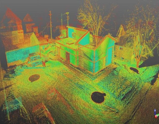
JPJ Engineering is fully equipped for 3D laser scanning and the process of delivering point clouds, project models, and high-definition mesh products. 3D laser scanning uses safe light lasers through a non-destructive technology to produce high-accuracy data points. By combining millions of closely spaced data points, the point cloud is created. These point clouds are then used to create a model or a high-definition mesh that represents the object's surface in an editable CAD drawing.
The digitization of real-world objects provides detailed as-built conditions for many technical applications.
Architecture
2D/3D building facades
2D plans
Building info. modeling
Building elevations
Roof surfaces
Interior surface scanning
Historical preservation
Construction
Site modeling
Volume calculation
Foundation certifications
Construction verification
Stockpile surveys
On-going as-built monitoring
Engineering
Industrial
JPJ Engineering offers 3D laser scanning with data capture at up to 216,000 points per second. This can rapidly produce high-accuracy, clean data that is unrivaled. The ability to produce high-accuracy data positions is ideally suited to a variety of industrial and high-accuracy civil applications.