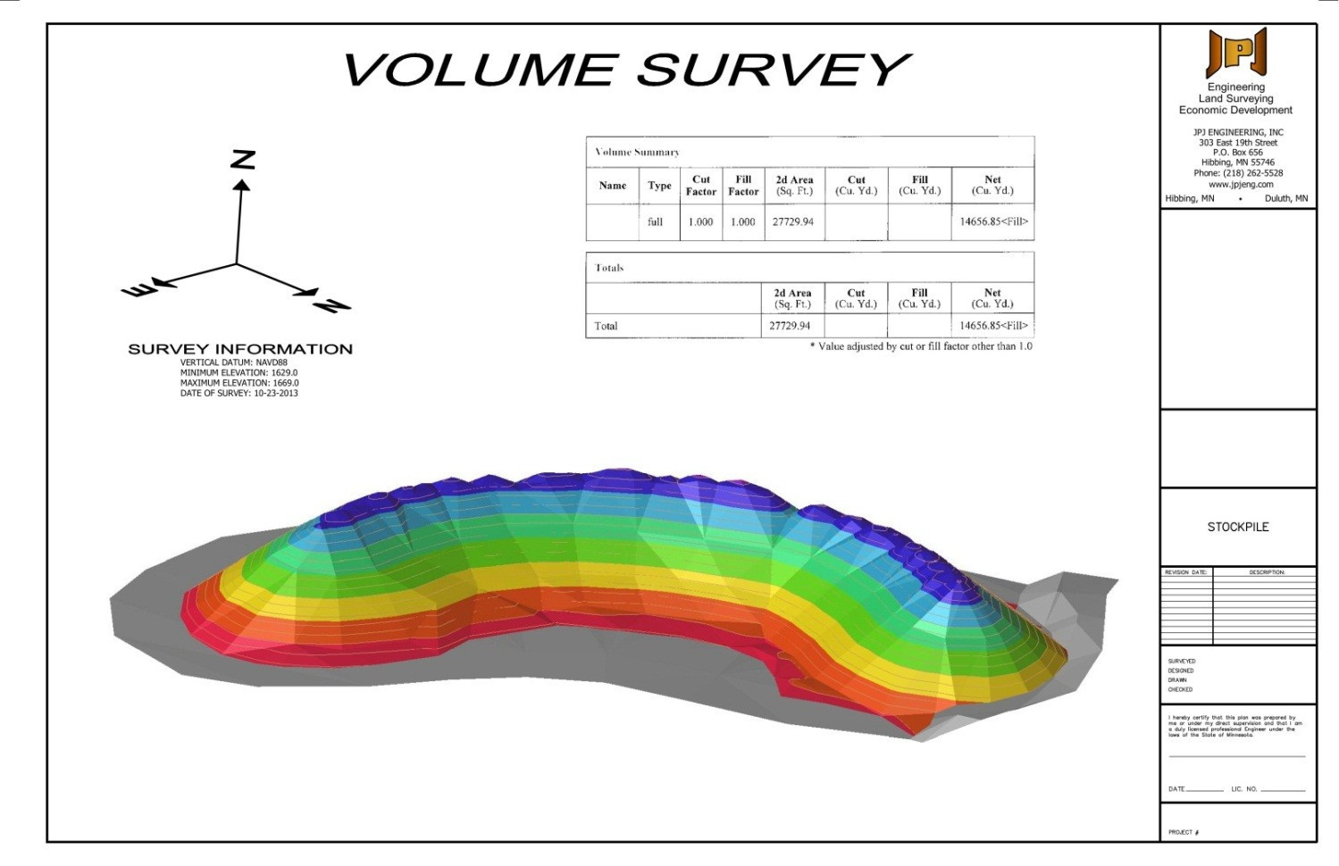
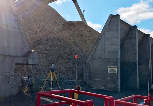
Measuring a stockpile volume using laser technology is by far the quickest and safest method available. It is also the most accurate. A long-range scanner collects thousands of data points to calculate the quantity of material in the stockpile. In reverse, volume surveys can also be used to calculate the quantity removed from large excavations that can be difficult to access for a traditional topographic survey.
The project deliverable is a map showing the stockpile, or excavation, and tabulated volumes in normal increments. Using our 3D laser scanning equipment, we can capture data at up to 15 points per second with millimeter-level accuracy. JPJ Engineering's long-range scanning technology provides fast acquisition of precise data with calculated volumes determined instantly.